Winter Tours
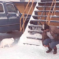
Yes there is wildlife in winter. Here a slope worker is feeding making friends with an arctic fox.
Tours of Alaska, Northern Lights, Arctic Ocean, Inside Passage and more!

 You
should never go to Alaska as a young man or woman because you'll never be
satisfied with any other place as long as you live.
You
should never go to Alaska as a young man or woman because you'll never be
satisfied with any other place as long as you live.
Yes there is wildlife in winter. Here a slope worker is feeding making friends with an arctic fox.
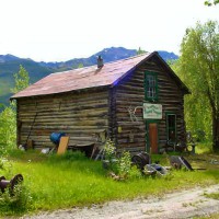
This is the old, historic Wiseman Trading Post. Our tours are steeped in rich, Alaska history!
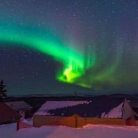
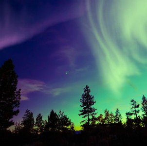
Some of the most spectacular light shows are created through nature itself. Breathtaking!
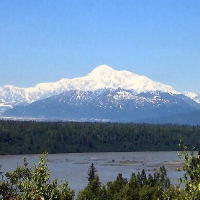
This photo of Denali was donated to us and is taken from the Parks
Highway.
Like the Dalton Highway, Deadhorse exists to support oil operations in
Prudhoe Bay. While the official population is 25, the town boasts a
non-permanent population of 2,000-3,000 employees of the various oil
operations. Like Coldfoot and the camp at Mile 60, the facilities for
visitors are the same as those built to house construction workers for the
Trans-Alaska Pipeline. All facilities are simple, prefabricated buildings
which were brought to Deadhorse on barge or via the Dalton. Commodities,
having to be shipped great distances, are expensive.
No direct
access to the Arctic Ocean, 10 miles away, exists from Deadhorse. Special
advanced access/tours via oil field personnel permission requiring photo ID
and right of refusal may visit Prudhoe Bay. Not all tours reach the Bay.
Click here to read about our Arctic Ocean
Adventure tour.
Description
![]()
In this document you will find detailed tour booking information & cancellation policy information.
PO Box 306
Leavenworth, WA 98826
1.509.433.1329
