|
We were RV’ing in British Columbia this summer, with an eye on
Alaska, and decided the time was right for the big trip. I always
wanted to drive to the Arctic Circle so we headed up the Alaska
Highway. After seeing most of the state we arrived in Fairbanks on
Aug 24th, 2008 and prepared to drive up the Dalton Highway.
Dave's Email:
DNorth3429@gmail.com
 |
 |
 |
|
Mile Zero |
End of the pavement |
Dusty Dalton |
|
August 25, 2008
We got up the morning of the 25th, went to Sam’s
Sourdough for breakfast, bought the extra spare tire as
recommended, loaded a weeks worth of groceries, and late on
the afternoon of Aug 25, 2008 started the adventure. The
plan was to drive as far as the Arctic Circle and stop at
Coldfoot. We got to the junction, at mile 73, of the Elliot
Highway and the Dalton Highway and right away the pavement
ended and the gravel began. The road is very dusty but hard
surface and just barley two lanes wide. It goes up and down
hills, steep 7% and 8% grades. The forest is black spruce,
and birch. The birch trees are starting to turn very golden.
Because of the late start we stopped the first night at mile
23, near Hess creek, at a beaver pond. It was well past the
summer solstice but the twilight lasted until midnight and
the first wildlife sighting, that night there were beavers
working on their house on the opposite shore. |
|
 |
 |
 |
|
Mile 95 |
Approaching Yukon Crossing |
Yukon Crossing |
 |
 |
 |
|
Coldfoot Trucks |
Approaching Coldfoot |
Mile 98 Kanuti River Drainage |
 |
 |
 |
|
Mile 129 |
Mile 132 Gobblers Knob looking North |
Mile 157 |
 |
|
|
|
Arctic Circle |
|
|
|
August 26, 2008
We left Hess creek around 10:00 AM and drove about 56 miles
to the Yukon River. We stopped at the Yukon River Camp, a
general store, café, and gas station, bought a tee shirt
and other souvenirs, all say something about the Arctic
Circle. After filling the gas tank I talked to a man who had
just come south on the road. He told us the road is good and
we must go to at least mile 311 for best scenery and a small
herd of musk ox. We continued on and crossed the Arctic
Circle at 4:16 PM, stopped at the information pullout, about
200 yards past the actual point according to my GPS, and
took pictures at the Arctic Circle sign. There was also a
tour bus and about 30 people at the sign taking pictures.
After getting our picture taken at the sign we went on to
Coldfoot, arriving around 7:30 PM. It’s very interesting
with big trucks, a café and lots of people from the same
tour bus. Saw some people we had talked with earlier in the
day one of them an older man had worked on the pipeline, he
had some interesting stories. All day long the road followed
the pipeline; the sky was clear and full of sunshine. We
camped a few miles past Coldfoot at Marion Creek around 8:30
PM. We had pizza to celebrate the crossing on the Arctic
Circle. |
|
 |
 |
 |
|
Camping at Deadhorse |
Caribou Inn Deadhorse |
Mile 325 Ice Cut |
 |
 |
 |
|
Mile 354 |
Mile 364 Franklin Bluffs |
GPS shows it all |
|
August 28, 2008
We left camp about 10:15 heading north to Deadhorse. The
morning was overcast and misty, the rest of the day was
cloudy, a high of 45 degrees. The landscape continues to be
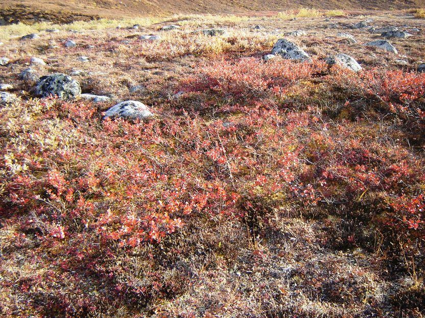
Arctic Tundra, very desolate but fabulous fall colors. The
very low, 6” to 8” shrubs, grasses, and plants are bright
yellow, orange and red with some brown. We saw a couple of
Caribou and two herds, 8 to 12 animals, of Musk Ox about 100
yards off of the road. We had to stop and pull off the road
twice to accommodate trucks carrying wide loads, 14 and 18
feet. We arrived in Deadhorse, Prudhoe Bay, at 4:30 PM. It
is a collection of construction companies spread randomly
over an area about 2 or 3 square miles. There is much hustle
and bustle with trucks and equipment going every which way.
Some of the buildings are two and three stories but set on
wood or steel blocks above the ground, so as not to melt the
perma frost. Everything here is in support of the oil
industry. There are 3 hotels for oil workers and tourists,
built from doublewide mobile homes connected together and
the restaurants are all cafeteria style with family seating.
We had dinner, $20.00 each, all you can eat pizza, fried
chicken, salad, and a large selection of deserts. We camped
near some kind of lake close to the entrance of town. |
|
 |
|
|
|
Grayling Lake Wayside |
|
|
|
August 31, 2008
Woke up around 9:30 and drove into Coldfoot for breakfast at
the café. The waitress said other people had seen the Aurora
also. We left Coldfoot around 11:30 diving south. We stopped
at Grayling Lake to take pictures of the fall color and
stopped again at the south fork of the Koyukuk River to pan
for gold, no luck. We drove on and stopped at finger
Mountain, a 40 foot spire use as a landmark for early
travelers. Continued on into Yukon Crossing and filled the
gas tank. We camped near there at 5 mile BLM campground. We
were up at 2:00 AM and we saw the northern lights again, but
not as intense as last night. Because we are further south,
the sky was much blacker and there were millions of stars
out. |
|
 |
|
|
|
Elliott Highway |
|
|
|
September 1, 2008
We got up around 9:30 AM and drove 5 miles south to Yukon
Crossing and had breakfast at the café. Some local
characters were in there with their six guns and Winchester
rifle eating breakfast. We left about 11:00 AM and headed
south, arrived in Fairbanks about 5:30 PM, the fall colors
continued to be gorgeous where they didn’t exist a week
earlier on the way up. We stopped at Denney’s, the most
northerly in the world, for a hot fudge sundae to celebrate
a successful adventure then went to a car wash and washed
the mud and dust off the truck with the high pressure
nozzle. The dirt roads are sprayed with calcium chloride to
keep the dust down which creates a lot of mud and it is very
corrosive. Then went grocery shopping, and camped at
Wal-Mart. The day was bright and sunny about 68 degrees in
Fairbanks. |
|
This was the absolute most
exciting road trip of my life, now I want to go back in the spring.
|