|
Milepost 115
Arctic Circle
The Arctic Circle is an imaginary line that marks
latitude 66° 33', the place
where the sun stays above the horizon for one full day
(about June 21) and stays below the horizon for one full day
at winter. (about December 21) If you travel 17 miles
farther to Gobblers Knob you can view the Midnight Sun.
There is an undeveloped campground near the Arctic Circle
sign. You'll want to take a picture of the sign and take in
the fantastic views. |
|
 |
 |
Milepost 150
Grayling Lake
Grayling Lake is a quite shallow and known for moose
feeding on it's nutrient-rich vegetation. A quiet peaceful
lake rich with history. |
|
Grayling Lake |
Grayling Lake |
|
|
Milepost 175 Coldfoot
(click
here for more information)
The Coldfoot Interagency Visitor Center is open
daily throughout the summer from 10 am to 10 pm. The staff
are there to guide you, give you safe traveling tips, and
there is even an interpretive slide presentation every
evening. Brochures are available and there is even an Alaska
Natural History Association Book Store. |
|
|
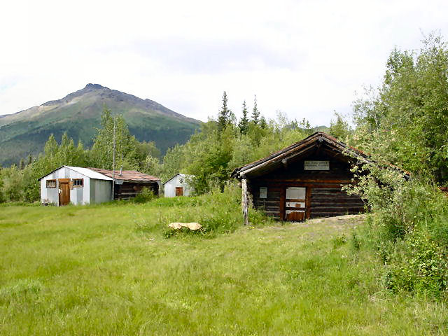
Milepost 189
Wiseman
Wiseman is located 3 miles west of the Dalton
Highway. It's an old gold rush town established in 1907.
This is one of the few non-Native communities located north
of the Yukon River, and is the farthest north gold rush
settlement in the Brooks Range still in existence today. The
town, throughout the years, has never been abandoned and
there are around 29 year around residents in Wiseman.
Please Note: All buildings in Wiseman are
privately owned. Even buildings that look abandoned. We ask
that you respect their property and not trespass. |
 |
 |
 |
|
Old Trading Post Building |
Old U.S. Post Office |
Wiseman Residence |
|
 |
 |
Milepost 204
Sukakpak Mountain
Elevation 4,459. This massive structure towers over
the Dalton Highway and is quite a geological wonder! Once a
limestone deposit and located about 30 miles north of
Coldfoot, it is a part of the Brooks Range. At certain times
throughout the years, ice has been seen through the splits
in the thin layer of soil and vegetation |
|
Sukakpak Mountain |
Sukakpak Mountain |
|
 |
Milepost 275
Galbraith Lake
This glacially formed lake is all that is left of a
lake that at one time extended the whole length of the
Atigun River Valley. If you take a left off the highway and
travel about 3 miles, there is an outhouse and an
undeveloped camping area. Here you'll enjoy sweeping views
of Brooks Range. |
|
 |
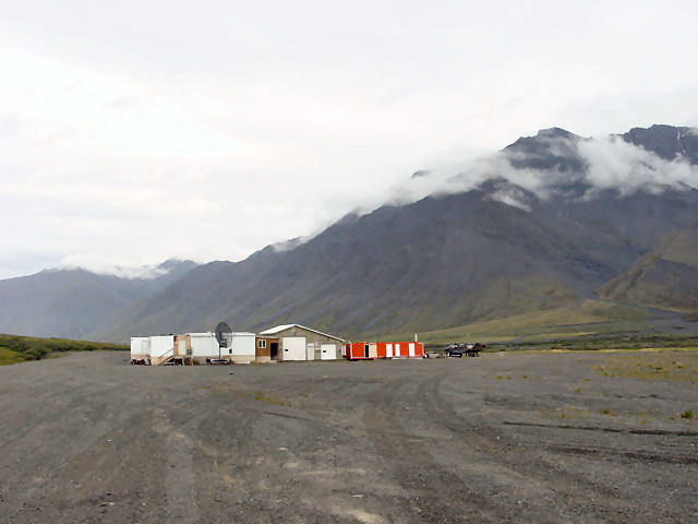
Milepost 284
Toolik Lake
There are no public services here as this is an
arctic research station location. Sensitive studies are
carried out at this location by researches and your
cooperation is appreciated in keeping out of the field
station and research sites. |
|
 |
 |
 |
|
Alyeska Pipeline |
Beaver Slide, Killer 9% incline |
Brooks Range - Photo 1 |
|
 |
 |
 |
|
Brooks Range - Photo 2 |
Brooks Range - Photo 3 |
Brooks Range - Photo 4 |
|
 |
 |
 |
|
Brooks Range - Photo 5 |
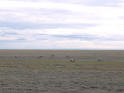
Caribou grazing by The Dalton Hwy |
Dalton Highway |
|
 |
 |
|
|
When wet, the Dalton becomes extremely muddy & slick. |
Long stretches of rolling
hills and killer grades |
|
|
Milepost
415 Deadhorse -
Click Here for more information